Home >> Oaxaca >> Xitla

Santa Cruz Xitla

GPS: 16°19'N 96°40'W
Elevation: 5938' (1810 m)

photos by Sheila Clarke

to the north
Oaxaca, Oaxaca
Ocotlán, Oaxaca
to the southeast
Santa Catarina Cuixtla
to the east
Miahuatlán
to the south
Chacalapa, Oaxaca
Pochutla, Oaxaca
Puerto Angel, Oaxaca
San José del Pacífico
Main Index
A Trip to the Mountains
Hwy 175
Balneario el Paraiso
Rancho Alegre
Regional Map [122K]
Living in Mexico
Spanish Vocabulary
Indigenous Language Map
Visitors' Comments
AboutHomeSearch
What's New?


Xitla blossoms with flowers   More Photos


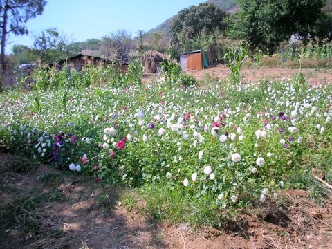
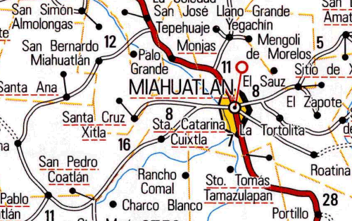
Xitla, Oaxaca, (pronounced ZEE-tlah) is a small Zapotec village 6 miles (9 km) west of Miahuatlán south of the capital city of Oaxaca. The word Xitla comes from the Nahuatl language and means place near the stars. The principal crop here is flowers. Corn, coffee, sugarcane, beans, and fruits are also grown in the area. Xitla has long been embroiled in land disputes with the neighboring village of Santa Catarina Cuixtla and is very suspicious of strangers. Read about Sheila Clark's visit to Xitla in her article on Exploring Miahuatlán.


| Top of page | Main index | Search | What's new |

The Pacific Coast of Mexico www.tomzap.com Tom Penick:  tom@tomzap.com