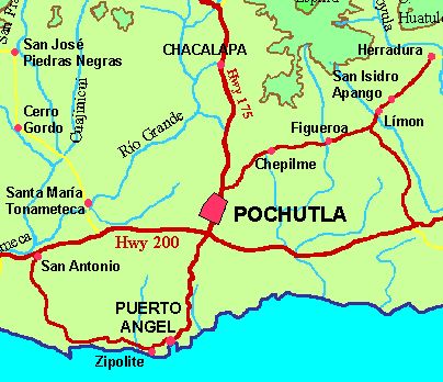
Chacalapa, OaxacaGPS 15°49.74'N 96°27.85'WChacalapa is a small town located in the foothills of the Sierra Madre del Sur about 14 km/9 miles north of Pochutla on the Pochutla-Oaxaca highway 175 (km 226). |
|
|
|
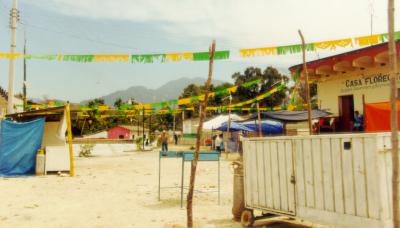
Chacalapa in preparation for its annual Día de San José (March 19) celebration. San José is the patron saint of several towns in this area, including San José del Pacifico. Normally, this would be where you would drive through to get to Balneario el Paraiso. |
|
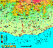
Chacalapa is located about 14 km/9 miles north of Pochutla on the Pochutla-Oaxaca highway 175. Regional map [122K]. The elevation is about 275 meters/900 feet, which is at the lower limit of the altitudes at which coffee can be grown here. |
![]()
Accommodations •
Habitaciones
I don't have any hotel information yet for Chacalapa. If you can provide me some, please do. tom@tomzap.com.
![]() www.tomzap.com
www.tomzap.com
![]() Tom Penick:
tom@tomzap.com
Tom Penick:
tom@tomzap.com