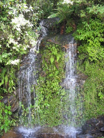
San Jose del Pacífico to Pochutla: You'll continue to climb for about another 10 minutes until you reach El Manzanal, then begin the descent. This portion of the trip takes about two hours and 25 minutes. The ride down is initially quite gradual, and then more pronounced once you reach San Miguel Suchixtepec, a picturesque village with large impressive church, and homes strung out along a few hilly mountain roads. You'll begin to detect another significant temperature change, depending on the facing of the portion of mountain you are descending relative to the sun. At different portions of the stretch you'll pass by a couple of waterfalls and three or four smaller rivulets spilling across the highway, goats and donkeys, home construction of wood, pine cones on the roadway, brilliant orange flowered bromeliads, wild orchids, large expanses of boston-like ferns, and perhaps one or two patches of fog. For several kilometers you'll encounter a sweet smell similar to that of maple syrup. Because of the steep descent, you may even detect the smell of burning rubber, but don't worry, it's likely a truck up ahead having brake problems. At about four hours into the trip you'll begin to hear tropical insect and bird sounds and calls, and see bananas and sugar cane under cultivation and for sale, with coffee and honey also offered at roadside stands. On the approach to Pochutla the roadway will then gradually straighten out, with curves much easier to navigate. Tropical grasses predominate the roadside landscapes. An indication that you're getting closer with be blown sand encroaching part of the roadway, and finally a sign stating "Iguana Hunting Prohibited." A short while later you'll see the sign pointing to the right for the Puerto Escondido bypass.
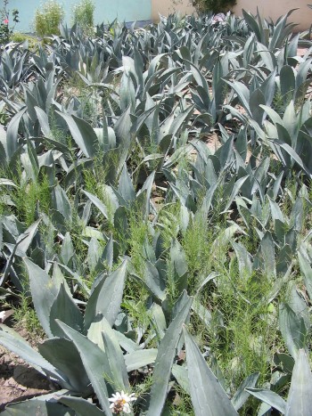
Pochutla to Puerto Escondido: Takes about an hour. Highway 175 ends at a “Y”, so veer to the right and you're on highway 200, following along the Pacific. However, you won't be able to see the ocean for about 40 minutes. You'll pass by the exit to Puerto Ángel, Mazunte and Zipolite. The entire final leg of the trip is basically straight and flat. For the last half hour or so you'll see mango, papaya and coconut under cultivation.
| |
ROUTE 131
Aside from the fact that this route should be quicker than 175, and is about 50 km shorter, there are other differences to note, in addition to similarities:
- While 175 is predominantly a single ascent, and then descent, 131 consists of several hills and valleys which must be negotiated, on a couple of occasions arriving in a town at the bottom of a valley, and then again beginning to climb. This may contribute to the roller-coaster effect on your stomach.
- The road quality is inferior on 131, in particular for about an hour in the approach to San Gabriel Mixtepec and thereafter, with potholes, poor attempts to repave, etc. However, until around the end of 2006 it was far worse. Now there are long stretches of fresh, new tar, and improvements continue.
- Immediately upon leaving Puerto you begin an ascent, so there is no gradual departure from the tropical climate.
- Much of the vegetation found on 175 is the same along 131, although it is less defined, in part because you do not climb to same altitude as on 175, and there are really no significant micro-climates which manifest in extremes of vegetation and particular commercial enterprise. Waterfalls are abundant, and landscapes are impressive, perhaps less so than on the other highway. There is much more livestock along the sides of the roadway than on route 175, predominantly donkeys and mules, so be a bit more vigilant.
|