San Juan CacahuatepecGPS: 16°47'N 98°09'WElevation: 1300' (400 meters) |
|
|
|
|
Cacahuatepec means Cocoa Hill and there are cocoa orchards located there. Cacahuatepec is an Amusgo community of about 8000 located on highway 125, 53km north of Pinotepa Nacional. It is the home of famed composer of romantic ballads, Álvaro Carrillo. It is a fertile agricultural region producing tobacco, peanuts, maize, beans, watermelons, sesame, mango, papaya, orange, and lemons. Before the Spanish conquest, Cacahuatepec was a Mixtec community. Within the city is a Mixteco structure made of boulders which was called Yucoshiva, meaning hill of the stone. |
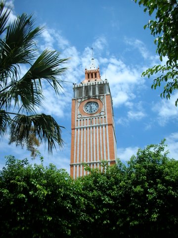 photo from Sheila Clarke |

Hotels • Hoteles
I don't have information on hotels in Cacahuatepec. If you can help, email me using the link below.
Help keep this information current. Email tom@tomzap.com with updates.
Ayúdenme a mantener ésta información al día. Envía tus actualizaciones por e-mail a tom@tomzap.com.
Restaurants • Restaurantes
I don't have information about restaurants in Cacahuatepec. If you can help, email me using the link below.
Help keep this information current. Email tom@tomzap.com with updates.
Ayúdenme a mantener ésta información al día. Envía tus actualizaciones por e-mail a tom@tomzap.com.
Celebrations • Celebraciones
Transportation • Transportación
Help keep this information current. Email tom@tomzap.com with updates.
Ayúdenme a mantener ésta información al día. Envía tus actualizaciones por e-mail a tom@tomzap.com.
Miscellaneous • Misceláneo
 www.tomzap.com
Tom Penick: tom@tomzap.com
www.tomzap.com
Tom Penick: tom@tomzap.com