Home >>
Oaxaca >>
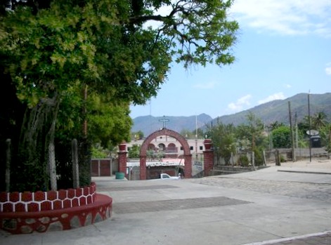
Santa María Zacatepec
Santa María Zacatepec
GPS: 16°45'N 97°59'W
Elevation: 1115' (340 meters)
|
|
|
Santa María Zacatepec is a community of 13,734 (2005) located in the Sierra Madre del Sur 47 miles (75 km) north of Pinotepa Nacional on highway 125. The word zacatepec means hill of hay in the tacuate tatacoatl dialect and was said to be inhabited by snakes. The city was under Mixtex rule for more than a century until it was overtaken by the Aztec in 1463.
Local farms produce corn, beans, chiles, watermelon, peanuts, tomatoes, squash, mangos, maney, avocado, guayabas, and limes.
One December 8, a fiesta celebrates the immaculate conception of Mary. Carnival takes place in March.
More Photos
| Top of page |
Main index |
Search |
What's new |
The Pacific Coast of Mexico
 www.tomzap.com
Tom Penick:
tom@tomzap.com
www.tomzap.com
Tom Penick:
tom@tomzap.com